ROCK R2A
The ROCK R2A is a complete aerial mapping solution, integrating the new LiVOX Avia sensor, with a Novatel GNSS, high-accuracy Inertial Labs IMU, and a 24 MP Sony camera. The system is used with the DJI M300, DJI M210, DJI M200, DJI M600 FreeFly Alta X, FreeFly Astro, SkyFish, and Mobile mapping. When used with the ROCK Cloud - complete deliverables are only a flight away.
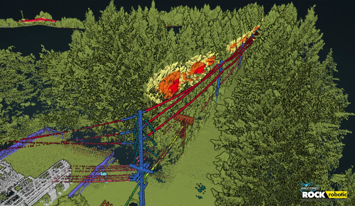
ROCK Vegetation Management
Transform raw point cloud data into Vegetation encroachment violations and export to GIS

![]()